- Distance 5 1/2miles (9Km)
- OS Map Explorer 22
- Parking at Holford Lay By, ref: 157 408
- Parking at Holford Green, ref: 154 411
- Parking at Great Wood, ref: 174 373
- Link to OS map
- Holford Information
Parking
This section of the walk can be started either from the lay-by off the A39 or from the car park at Holford Green. If you are travelling from Bridgwater the large lay-by is on your left about 1/4 mile before Holford, there is often a refreshments van parked here. To reach the Holford Green car park it is best to continue past the lay-by and turn left shortly after the bollards in the middle of the road.
Route
Starting from Holford Green car park, follow the lane uphill towards the centre of the village. At the end of the lane turn right and take the first turning on the left. The narrow lane goes uphill and drops down into the lay-by -- keep dogs and children under control here! Distance about 1/4 mile and well signposted.
At the lay-by go through the gate leading up to Woodlands hill (pic 2). The footpath leads gently uphill, through the woods for about 1/4 of a mile before breaking into the open, over Woodlands Hill and continuing towards (but not reaching) Dowsborough Hill Fort. Height gain approx. 130m (425ft). Although it is the highest point, the hill fort is not really worth a detour being covered in trees and now having a limited view. This may change since there are plans afoot to create some viewpoints from the fort. (pic 3 &4).
A few hundred yards after a small cairn follow the signpost west. The path roughly follows the 250m contour line and leads into mainly deciduous woodland. This stretch is a bridleway and parts of the woodland can be muddy underfoot in wet conditions. You emerge onto a small lane at Five Lords (ref. 169 395). Look out for the signpost on your right if you are coming on the road from the other direction! (pic 5)
Follow the lane due east for 1/4 mile until the road turns very sharply to the left. The path goes through a gate straight ahead. Go straight across the fields, heading towards a wooden gate in the hedge (pic 6 &7).
Through the gate, turn right (south), and head downhill along this old green lane. It's rather rocky going and downhill. The banks here are full of rabbit runs and I've seen fox cubs playing along this lane on summer evenings. At the bottom of the hill another footpath crosses the route by a lone cottage. The Greenway continues straight on, across a shallow ford and continues on to a made-up lane. Being a dead-end the lane carries little traffic and, apart from the uphill start, provides a rather nice walk through a canopy of trees.
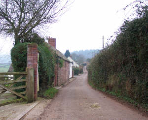
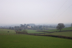
At the end of the lane you reach Bincombe Green (ref. 182 388). There is a seat in the middle of the green just on your left but you eschew such luxury, turn right and take the first turning on the left along another quiet lane. There are good views towards Over Stowey church on the left (south-east, pic8 & 9)
Continue along the lane for about 1/2 mile and look out for the farm gate on your right (south-west) - the signpost may be easy to miss (pic 10). Go through the gate and follow the hedge boundary on your right (pic 11). This leads to a wooden gate and the footpath goes a short distance through some trees, straight across an unmade track, then back into coniferous woodland before dropping onto a wide track in Great Wood just opposite Great Wood Camp (not a campsite and privately owned!). Turn right (west) along the track and continue for about 1/4 mile until you reach the car park (pic12 & 13).
The Greenway turns left here and then doubles back towards the east along the other side of the combe. If you are in need there are public conveniences in Rams Combe, about 1/4 mile to the west, straight along the track you have just been walking.

Pic 1
Bin Combe, looking towards Nether Stowey

Pic 2
Start of walk from lay-by on A39

Pic 3
North to Bristol Channel from Woodlands Hill

Pic 4
South to Dowsborough Fort from Woodlands Hill

Pic 5
Through woods towards Five Lords

Pic 6
Lane along Five Lords

Pic 7
Looking across fields from Five Lords

Pic 8
Turn right, then first left along this lane

Pic 9
View to Over Stowey from lane in pic 8

Pic 11
Follow the hedge boundary to the gate

Pic 13
Car park in Great Wood

Pic 10
Don't miss the signpost!

Pic 12
Wide track in Great Wood

